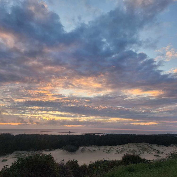
Driving North:
Bolon Island
Located at the confluence of the Smith and Umpqua Rivers, Bolon Island was once the traditional
camping ground of Native Americans. The trail extends half way around the island, providing views
of the Umpqua River. Bird watchers will enjoy a rare opportunity to visit a double-crested cormorant
rookery, home to hundreds of birds that typically nest in more remote areas. Bolon Island Tideways
State Scenic Corridor is a day use area only and is free of charge. There are no facilities on site.
Directions: Drive 0.5 miles north of Reedsport on US 101; after driving over the Umpqua River
Bridge, trailhead is immediately on the left
Length: 0.5 miles (one way);
Difficulty: Easy
Tahkenitch Dunes and Threemile Lake
Tahkenitch Dunes and Threemile Lake Trails begin as one trail before separating about 0.25 mile
from the trailhead. Each can be hiked separately or the two trails can be combined into an extended
loop. The north (right) fork visits Tahkenitch Dunes, passing through coastal forest with views of the
dunes and ocean. After descending through a stand of shore pine, the trail ends at the beach. Poles
in the sand mark the trail. The south (left) fork weaves through groves of giant Sitka spruce to quiet
Threemile Lake. A 0.3 mile trail continues to the beach. Hikers can connect the two trails by walking
along the beach. Fee/pass required for parking. Facilities available at trailhead.
Directions: Drive 8 miles north of Reedsport on US 101; trailhead is at milepost 204
Length: 2 miles for Tahkenitch Dunes (one way); 3 miles for Threemile Lake (one way); 6.5 miles for
both (loop)
Difficulty: Moderate to Difficult
Tahkenitch Creek
This trail follows Tahkenitch Creek through coastal forests and wetlands to open sand dunes. Hikers
can choose to take a short loop, a longer loop, or go all the way to the beach. This trail also connects
with Tahkenitch Dunes Trail. Fee/pass is required for parking. Vault toilet at trailhead.
Directions: Drive 9 miles north of Reedsport on US 101; trailhead is at milepost 202
Length: 1.5 miles (short loop) and 2.5 miles (long loop); 2.5 miles to the beach (one way)
Difficulty: Moderate to Difficult
Oregon Dunes Overlook
A half-mile paved trail leads to the lower, middle, and upper viewing decks. By following trail posts in
the sand, hikers may continue from the upper viewing deck directly to the beach (about one mile)
and loop back through open dunes, tree islands, coastal forest, and wetlands. A fee/pass is required
for parking. Facilities available at trailhead.
Directions: Drive 11 miles north from Reedsport on US 101; turn left (west) at Oregon Dunes Day
Use Area near milepost 200. Follow Oregon Dunes Overlook Drive 0.3 miles to the parking lot.
Length: 0.5 miles to viewing decks (one-way); 5.3 miles to beach and dunes (loop)
Difficulty: Easy to Moderate; viewing decks are wheelchair accessible
Carter Dune
At the interface of the trees and sand, hikers can follow the blue-striped trail post that mark the
through the dunes to the beach. Wildlife abounds in the deflation plain, which is often flooded in
winter. This trail connects to Taylor Dunes Trail. Fee/pass required for parking. Facilities available at
trailhead.
Directions: Drive 13 miles north of Reedsport on US 101; turn left (west) at Carter Lake Campground.
Trail begins from campground.
Length: 1.5 miles to beach (one way)
Difficulty: Easy to Moderate
Taylor Dune
The first half-mile of this trail is wheelchair accessible, leading to two viewing decks and a bench
overlooking nearby lakes, sand dunes, deflation plains, and the ocean. After winding through forest,
rhododendron groves, and marshes, the trail meets with the Carter Dune Trail to reach the beach.
Fee/pass required for parking. Vault toilet at trailhead.
Directions: Drive 13 miles north of Reedsport on US 101; turn left (west) at Carter Lake Campground.
Trail is immediately on the right of the road.
Length: 2 miles to beach (one way)
Difficulty: Easy to Moderate
Stagecoach Trailhead
Three short and interesting trails depart from this trailhead. The Waxmyrtle Trail, 1.5 miles one way,
follows the Siltcoos River through saltwater estuary, ending at the beach. The Chief Tsiltcoos Trail, a
1.25 mile loop, winds up and down through coastal forest. The Lagoon Trail, located 0.25 miles east
of the trailhead, is a 1 mile loop around a wildlife-rich oxbow lake, an old arm of the Siltcoos River.
Fee/pass required for parking. No trailhead facilities, although adjacent campgrounds provide
restrooms and water.
Directions: Drive 13.5 miles north of Reedsport on US 101 to milepost 198; turn left (west) onto
Siltcoos Beach Road. Drive an additional 1 mile to trailhead.
Length: 1.5 miles for the Waxmyrtle Trail (one way); 1.25 miles for the Chief Tsiltcoos Trail (loop); 1
mile for the Lagoon Trail (loop)
Difficulty: Easy
Siltcoos Lake
This trail descends through mature coastal forest to the western edge of Siltcoos Lake. Sounds in the
forest are muffled by a deep carpet of hemlock needles, and the dense canopy overhead shelters
hikers from the sun in the summer and the rain in the winter. Massive stumps remain from logging
in the 1930’s; look for evidence of notches that once held springboards, the planks on which loggers
stood while hand-sawing a tree. Halfway to the lake, the trail splits to form a loop. Both directions
reach the lake in about a mile. Fee/pass required for parking. Vault toilet on trail.
Directions: Drive 13.5 miles north of Reedsport on US 101 to milepost 198; turn right (east) into
trailhead parking.
Length: 2.25 miles (one way)
Difficulty: Moderate
Driving South:
Lake Marie
Located at Umpqua Lighthouse State Park, this trail circles picturesque Lake Marie. The trail begins
from a sandy swimming beach and provides access to several swimming and fishing points around
the lake. A short spur trail on the western side leads to open sand dunes. Facilities available at the
free day use area of the park.
Directions: Drive 5 miles south of Reedsport on US 101; at Winchester Bay, turn right (west) onto
Salmon Harbor Drive; in 1 mile turn left (east) onto Lighthouse Road; drive 1 mile to the park, just
past the Umpqua River Lighthouse. The trail connects to both ends of the sandy beach.
Length: 1 miles (loop)
Difficulty: Easy
Eel Lake
Located at William M. Tugman State Park, this trail hugs the edge of Eel Lake through groves of
centuries-old cedar, quickly rewarding hikers with spectacular water views and showcasing the
diversity of a mature coastal forest. Cougar and other lesser-seen wildlife frequent the area. The trail
does not circle the lake completely, ending near its marshy inlet on the far side. This trail is also
open to bicycles. Facilities are available at the free day-use area of the park.
Directions: Drive 8 miles south of Reedsport on US 101; turn left (east) at Tugman State Park (past
milepost 220); follow signs to the day use area. The trail starts at the bridge to the right of the
restrooms.
Length: 3 miles (one way)
Difficulty: Easy to Moderate
Hall and Schuttpelz Lakes
Hikers on this short trail system have the option to circle two forest lakes or climb to the edge of the
largest dune field on the Oregon Coast. The top of the dunes offers views of the lakes and ocean.
From here, hikers can pick their way to the beach or join the adjacent John Dellenback Trail. Parking
is free. Toilets available at trailhead.
Directions: Drive 8 miles south of Reedsport on US 101; turn right (west) onto Wildwood Drive across
the road from the signs to Tugman State Park; drive 0.75 miles to the gravel entrance and 0.25
additional miles to parking lot. Sign at entrance.
Length: varies
Difficulty: Easy to Difficult
John Dellenback Dunes
This trail provides access some of the most impressive sand dunes on the Oregon Coast. Hikers can
reach the trail from either the John Dellenback Dunes Trailhead or Eel Creek Campground. The John
Dellenback Dunes Trailhead branch consists of a loop that itself makes for an easy nature walk. Past
the junction of the two trailheads, the trail continues through the forest to the edge of the sand
dunes. From here hikes can pick their way through tree islands and low-lying marshes to the beach
(no marked trail) or explore the hidden lakes and wind-sculpted slopes of the immediate dunes.
Fee/pass required for parking. Facilities are available at trailheads.
Directions: Drive 10.5 miles south of Reedsport on US 101; turn right (west) at Eel Creek
Campground, or continue 0.25 miles further south for the John Dellenback Dunes Trailhead, also on
right.
Length: 0.3 miles to dunes (one way); 2.7 miles to beach (one way)
Difficulty: Easy to Difficult
Driving East:
Kentucky Falls
This remote trail visits three breathtaking waterfalls. An initial descent rewards hikers with a view of
the 90-foot Upper Kentucky Falls. The trail continues down moderate switchbacks to the 100-foot
Lower Kentucky Falls and North Fork Smith Falls, twin waterfalls that can be viewed simultaneously
from certain vantage points. A semi-maintained trail continues 5 miles beyond the Lower Kentucky
Falls; check conditions before hiking on extended trail. No fee or permits required; no facilities at
trailhead.
Directions: Drive 0.5 miles north of Reedsport on US 101; turn right (east) and continue 11 miles on
the Lower Smith River Road o North Fork Road #48; turn north and continue 7.6 miles, turn right
(east) on Road #23. After an additional 10.5 miles, turn left (northwest) on Road #919 and proceed
2.8 miles to the trailhead
Length: 0.8 miles to Upper Kentucky Falls (one way), additional 1.4 miles to Lower Kentucky Falls
(one way)
Difficulty: Moderate
Loon Lake Falls
This trail departs from the beach at Loon Lake. After passing through an old growth fir, spruce, and
hemlock forest along the lake shore, the trail takes a short climb to the falls. Hikers can walk directly
to the base of the cascading water. A bench provides a spot to rest and enjoy the scenery. A fee is
required for parking. Facilities available at the trailhead.
Directions: Drive 13 miles east of Reedsport on Highway 38; turn right (south) at signs for the Loon
Lake Recreation Area; drive 7 miles and turn right at the Loon Lake Recreation Area; continue to the
end of the day use parking lot. The trail is located to the right of the beach/picnic area near the
restrooms.
Length: 0.5 miles (one way)
Difficulty: Easy
The Devil’s Staircase
The existence of Devil’s Staircase, a 50-foot tiered waterfall hidden within one of Oregon’s wildest
forest, was not confirmed until the 1980’s. This legendary waterfall can only be reached by
bushwacking through dense virgin old growth, home to cougars, black bear, bobcats, and other
wildlife. Only hikers with strong navigational skills should consider the journey, as many hikers have
lost their way among unmapped ravines. A guide is strongly recommended; public guided hikes are
occasionally offered by local agencies. No facilities available.
Directions: Accessible via NF-41 between the Smith and Umpqua Rivers, approximately 16 miles east
of Reedsport. Contact the BLM for more info.
Length: 4 miles (one way); a hike to the falls can take a day or more, if you can find them
Difficulty: Extremely difficult